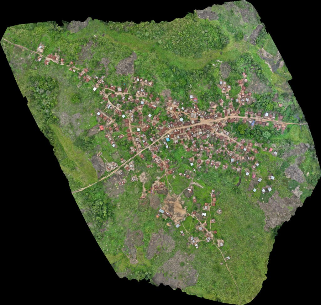
May 2023. Seizing the opportunity of a few hours of remaining daylight at the end of a busy day of drone mapping in eastern Sierra Leone for Project SAPLING, the UAVaid drone team mapped the community of Mansofinia. This remote community lies south east of the Loma mountains and the UAVaid team’s primary area of operations in Mansonia, where they had been working with TCS and CAiSL.
Needing to act quickly and ensure that all protocols were observed correctly, permission for drone flights and mapping the village was sought from the Mansofinia community chief. The community engagement was led by John Brima, Assistant Director of Forest Research and Extension, Ministry of Environment and Climate Change, Forestry Division, working with UAVaid co-founder and programme lead Daniel Ronen. The community chief, with his deputies, kindly granted this permission.
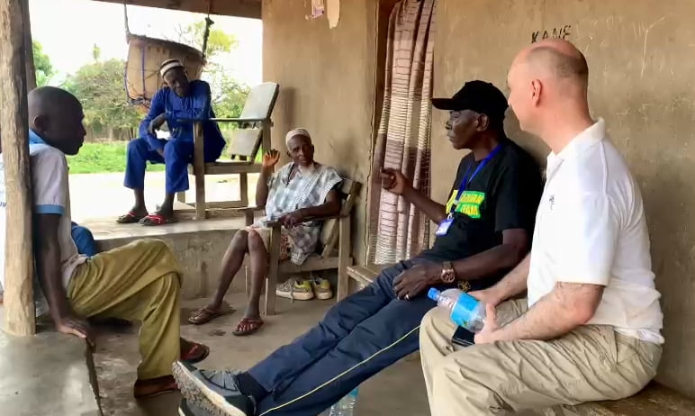
Following this meeting, permission was sought and obtained from the local police office, only after which did drone flights commence. As with most drone flying in this type of context, we attracted a lot of attention from the local children. As part of our community engagement and sensitisation, they were encouraged to watch us set up under the supervision of local adults who ensured everyone was moved back to keep a safe distance from the launch/landing area once we were ready for flight.

Within 1 1/2 hours, local permissions had been sought and obtained, community engaged and sensitised, all protocols observed, UAVaid flight operations safety procedures followed and the community of Mansofinia was mapped at 2cm / px resolution. An unexpected bonus for a very successful day.
With a dearth of high quality maps of rural areas in Sierra Leone, the high resolution imagery achieved by UAVaid drones will assist with local engagement and community planning and act as a template for future mapping projects.